RD1000 History
Reclamation District No. 1000 (RD1000) was created by an act of legislation, AB1475, on April 8, 1911, with the duty to provide flood protection and public safety to residents, businesses, schools, and agriculture. RD1000 is a special district formed by the California State Legislature.

1850 - The Swamp Land Act declared that swamp land will be given to the states with the condition that the land will be reclaimed and be put to good agricultural use. Much of the state's swamp land, considered to be land that flooded frequently, was previously federally owned.
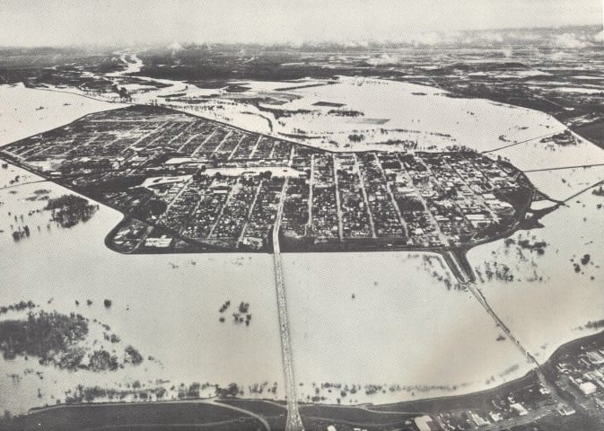
1862 - The Great Flood of 1862 was the worst in California’s flood history. Sacramento was inundated with several feet of water for weeks. Over 4000 people perished in this event. The resulting damage crippled the state's infrastructure and economy for decades. The need for a reliable flood protection plan had become abundantly clear.


January 21, 1880 - State Engineer William Hammond Hall submitted a report to the California legislature suggesting canals be used to divert Sacramento River flood waters and to expand the capacity of the main channel. This is considered to be the beginning of the first comprehensive flood control plan in Sacramento.
1911 - AB1475 establishes RD1000. RD1000 has been entrusted with the flood protection of the Natomas community since. The boundaries of the district lie between the Natomas East Main Drain Canal, the Sacramento and American Rivers, Levee Road, and the Pleasant Grove Creek Canal.
August 1912 - East Levee work began. This work was completed in December 1914
October 1912 - Cross Canal Levee work began and was completed in November 1914
March 1913 - Construction of drainage canals began with 127 miles complete by January 1917.


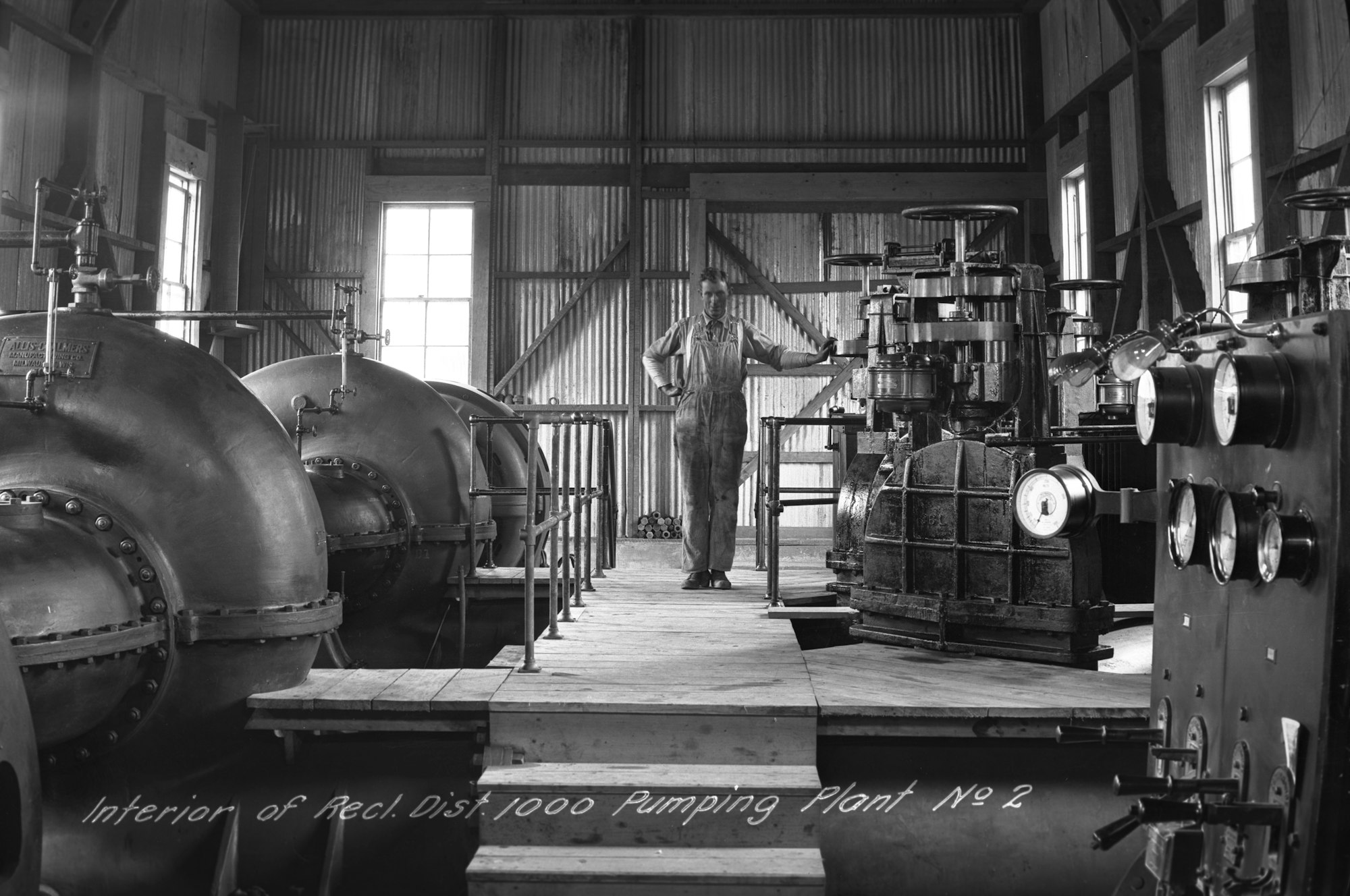
1914 - Pumping Plant 1A was the District's first pumping plant. This plant was built at the lowest elevation in the district and was originally designed to pump all ordinary runoff in the district into the Sacramento River. The plant is located between Gateway Oaks and Orchard Lane along Garden Highway at the end of the Main Drainage Canal. It is constructed adjacent to the RD1000 District office.
1917 - Pumping Plant 2 is constructed, the first for the District designed for inflows and outflows into the Sacramento River.
1938 - The Great Flood of 1938 pushed District flood infrastructure to its limits. Seepage was widespread throughout the district. The already existing Plants 1A and 2 were at full capacity despite 24-hour operation. This subsequently prompted the construction of Pumping Plant 3.
.jpg?ixlib=rb-1.1.0&w=2000&h=2000&fit=max&or=0&s=3db7a8d23c8ec1b79ae5f3e037473dba)
1955 - The Great Flood of 1955 causes historic flooding north of Natomas. Although the majority of the flooding happened elsewhere, the District's infastructure was tested once again. The strain highlighted once more the need to improve and expand flood protection infrastructue.
1959 - Pumping Plant 1B is constructed adjacent to Pumping Plant 1A with the largest pumping capacity of all the RD1000 pumping plants.
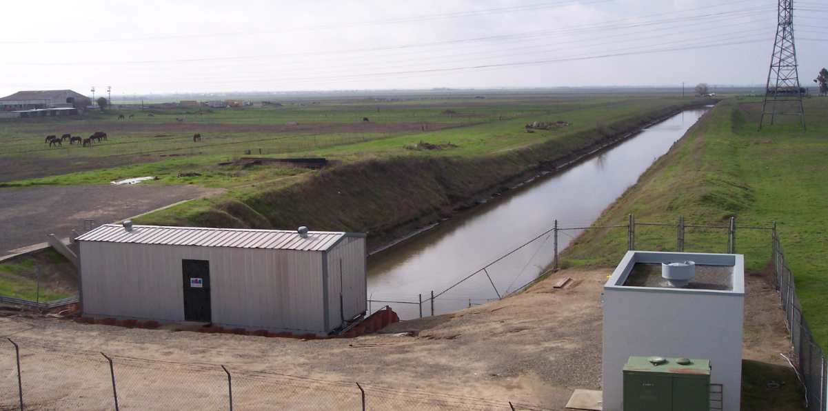
1964 - Pumping Plant 4 was constructed to accommodate development in Sutter County. It is the northernmost plant in the District, located in Sutter County at the end of the North Drain and on the Natomas Cross Canal.
.jpg?ixlib=rb-1.1.0&w=2000&h=2000&fit=max&or=0&s=5e7797320f368c3ff4be4fa31725e880)
1965 - Pumping Plant 5 was constructed in anticipation of increased run off from the Sacramento Airport which completed construction in 1967.
1974 - Pumping Plant 6 was constructed as part of City of Sacramento agreement to handle increased runoff from the development and urbanization of South Natomas. This plant is used sparingly due to resident concerns.
1983 - Pumping Plant 8 was constructed to accommodate increased runoff from a developing North Natomas.
1986 - The Great flood of 1986 tested the capacity of the District's flood protection infrastructure and caused significant flooding North of the District, along the Feather River. The aftermath of 1986 prompted the reconstruction of Pumping Plant 4 to better mitigate runoff from stormwater and agricultural drainage.
.jpg?ixlib=rb-1.1.0&w=2000&h=2000&fit=max&or=0&s=2688243d38c859951d20731d1b45c847)
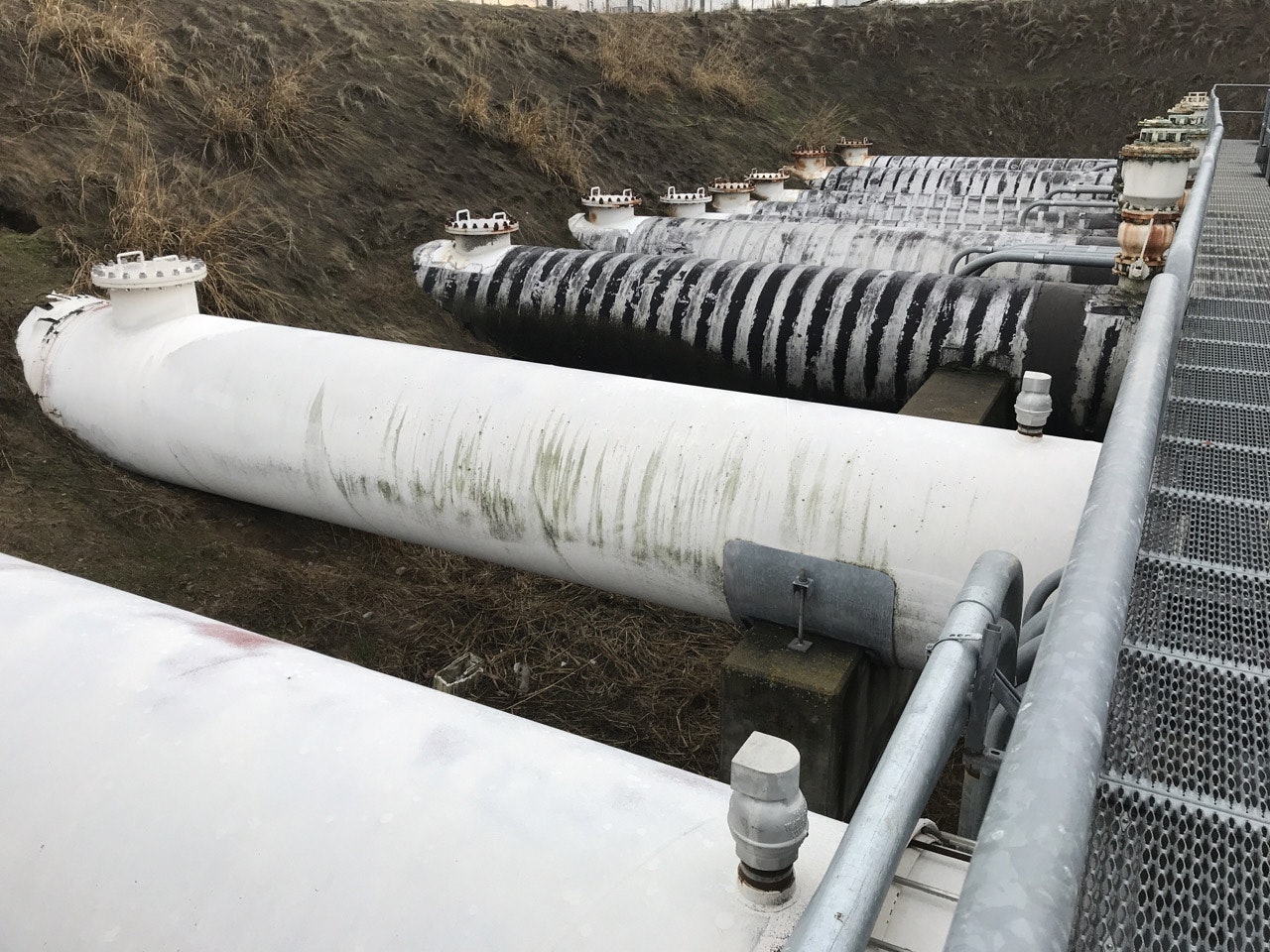
2006 - The Great Flood of 2006 once again pushed District infrastructure to the brink of failure. The storms caused a sinkhole to form under Puming Plant 2, resulting in the plant nearly being lost. Plant 2 was subsequently reconstructed and relocated.

2008 - FEMA remapped the Natomas flood plain. The process effectively decertified the District's levees and placed a building moratorium on development. Eventually, this led to the development and approval of the Natomas Levee Improvement Project (NLIP), which currently seeks to recertify the District's interior levee system.
2012 - Construction and relocation of Pumping Plant 2 is completed as part of the Natomas Levee Improvement Plan (NLIP)
2015 - The building moratorium on development is lifted in Natomas allowing for development to begin again in the basin.
2020 - The RD1000 Board of Trustees adopted the Capital Improvement Plan, which prioritizes capital assets and projects critical to keeping Natomas flood-safe.
2021 - The RD1000 Board of Trustees adopted the Comprehensive Financial Plan. This plan included all expenditures, revenue sources, capital improvement costs, reserves, repair and revenue costs, and net revenue requirements. It established guidelines for reserves and funding for the Capital Improvement Plan.
March 2023 - Prop 218 Vote to adopt Stormwater Fee was approved by Natomas community voters. This measure will fund infrastructure projects and much-needed repairs and upgrades to pumping plants.
2024 - The District, with the support of the US Army Corps of Engineers, will begin CIP construction work, ensuring a flood-safe future for Natomas
2025 - The Natomas Levee Improvement Project is anticipated to be complete to allow FEMA to recertify the levees to 200-year flood standards.
.png?ixlib=rb-1.1.0&or=0&w=720&h=720&fit=max&auto=format%2Ccompress&s=cffd9acf299d09e7fe35141bdeefb002)


.png?ixlib=rb-1.1.0&or=0&w=720&h=720&fit=max&auto=format%2Ccompress&s=a1e3d5404a3b9280e6538ec991ea7245)